 Qiang Huang
What's Inside
I've lost count how many times I've pulled out a paper map for bewildered tourists in Xitang. Google Maps? Useless here. Your phone's GPS? Often points you into a canal. Let me save you the embarrassment—this guide is the only map you'll need.
Xitang's maze of alleyways and bridges is charming but confusing. I've seen couples argue, families split, and solo travelers circle the same spot three times. The secret isn't a better phone—it's knowing which landmarks to follow.
Here's the bottom line: get a physical map from the ticket office, or screenshot my recommended route below. Digital maps work offline if you download before arriving. Now let's dive in.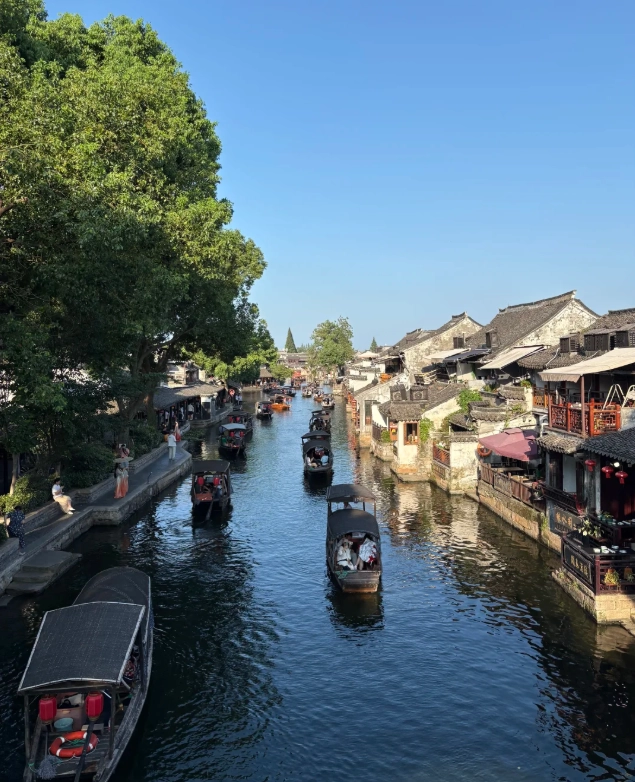
Why You Need a Map (Not Your Phone)
Google Maps is blocked in China, and even with a VPN, its data for Xitang is outdated. I've watched tourists walk into dead ends that don't exist on the map. Apple Maps works slightly better but still misses many small lanes. Your best bet: use AMap (Gaode) set to English, or carry a paper map.
Another headache: WeChat Pay and Alipay are king here. Most shops, including map vendors, won't take cash or international cards. Make sure your Alipay is linked to a foreign card (like Visa or Mastercard)—it works in 90% of places.
Xitang Map Essentials: What Every Visitor Should Know
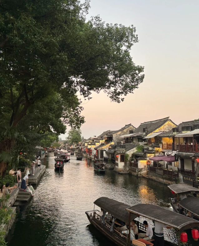
The town is shaped like a 'Y' divided by three main waterways. Most attractions cluster around the northern and eastern sections. The entrance (south gate) leads you into the busiest area—expect crowds between 10am and 4pm.
Key Landmarks to Anchor Your Mental Map
- Zui Yuan (Drunken Arbour) – A quiet garden in the east, perfect for early morning photos.
- Yan Fang Bridge – The most photographed bridge; arrive before 8am to avoid selfie sticks.
- West Street (Xijie) – Lined with food stalls and souvenir shops; leads to the wine museum.
- North Gate – Less crowded entrance, often used by locals. I send my guests here.
Map Marks That Matter
Look for the 'WC' symbols—public toilets are rare. The ones near the south gate always have queues. I advise using the clean restroom at the visitor center before entering. Also note the four main parking lots (P1-P4). P3 is closest to the north gate, but P1 has more shuttle buses.
Must-See Spots on the Map (Ranked by 'Worth the Detour')
I've ranked these by personal experience after 100+ visits. Skip the ones that are overcrowded hype.
- Xiyuan (West Garden) – A serene classical garden with a pond. Most tourists miss it because it's off the main east-west axis. Directions: From Yan Fang Bridge, walk south 3 minutes; look for a small stone archway.
- Wine Museum – Learn about rice wine brewing. The tasting is free, but the gift shop is pricey. Insider move: Buy a small bottle from the local shop next door for half the price.
- Nest Steps (Guchao Lane) – A narrow alley that camera-toting tourists love. Best light: 3-5pm when the sun slants through the eaves.
- Night Boat Ride – Departs from the central pier near the south gate. Cost: 100 RMB per person (20 min). Pay in Alipay—no cash accepted. Tip: Book at 6pm to catch sunset and lit lanterns.
What to Skip (Yes, I'm Being Honest)
The 'Sculpture Exhibition' on the map is a dusty room with modern art that clashes with the ancient vibe. Also skip the 'Old Street' section between noon and 2pm—it's an oven with no shade. Instead, grab a tea house along the canal and watch boats go by.
Walking Routes Based on Your Time
I've designed these routes using the map to maximize what you see and minimize backtracking.
If You Have Half a Day (4-5 Hours)
Start from North Gate (less crowded). Enter, walk south along the western waterway. Stop at Zui Yuan (30 min), then cross Yan Fang Bridge (photo stop, 10 min). Continue to West Street for lunch. After eating, head to the Wine Museum (40 min). Loops back via the south gate around 2pm. Total walking: ~3 km, all flat.
If You Have a Full Day (8 Hours)
Add the eastern loop. After the half-day route, rest at a tea house (I like Yunxiang Tea House on North Street; a pot of green tea costs 30 RMB, and the view of the canal is unmatched). Then explore the eastern alleyways—less crowded, more authentic. Visit the Embroidery Museum (free). End with the night boat ride.
Plan B for Rainy Days
Xitang's charm persists in rain, but your phone map might glitch. Head for covered walkways along North Street. Visit the indoor Xitang Folk Museum (20 RMB). Grab lunch at Lao Tie Guo (Old Iron Pot) on West Street—their braised pork melts in your mouth. The restaurant has picture menus, so pointing works.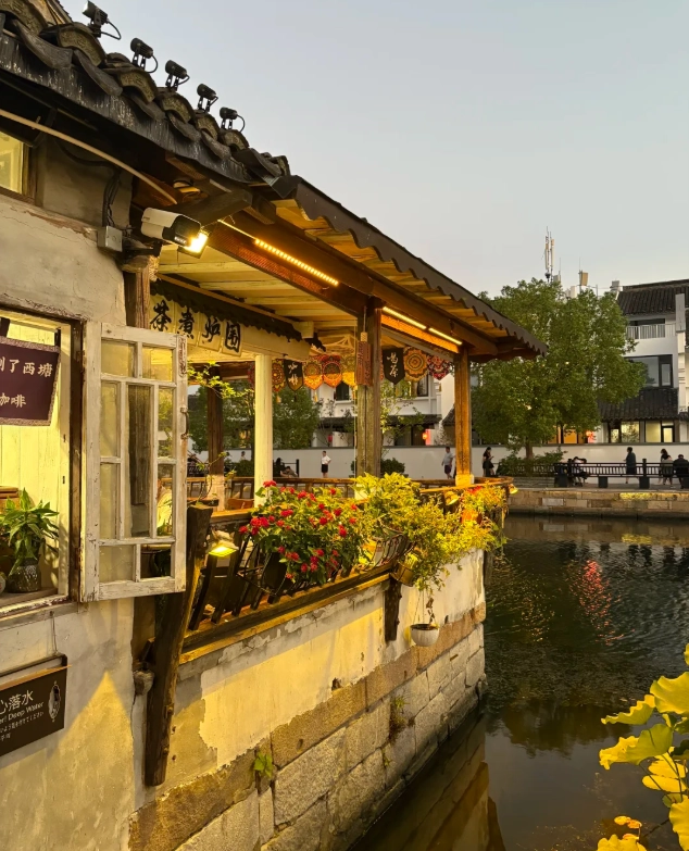
Navigation Tips for Foreigners: Avoiding Common Pitfalls
Let me walk you through the gotchas I see every week.
- Maps offline? Use 'Maps.me' app. Download the China map before departure. It uses OpenStreetMap data, which is fairly accurate for Xitang's main paths.
- Show addresses in Chinese. When taking a taxi or DiDi, always show the driver the Chinese name. DiDi app has an English version, but many drivers ignore the English name. Key Chinese: 西塘古镇 (Xītáng Gǔzhèn).
- Don't trust the ferry schedule. The map shows ferry stops, but boats run irregularly after 5pm. If you want a ride, head to the main pier and negotiate with the boatman directly (cash rarely accepted—use Alipay).
- Watch out for 'shortcut' touts. Near the south gate, people offer to lead you through 'secret' entrances for a fee. They're just taking you to the regular ticket gate. Buy your ticket at the official booth (成人票 95 RMB, check Trip.com for discounts with passport).
FAQ About Xitang Maps
Verified and fact-checked by the editorial team.


Best 15 yuan I spent in Xitang! The map had me eating at a family-run noodle shack that wasn’t on any other guide. The little anecdotes about the stone bridges made me feel like I was walking through history. I actually bought two—one for my sister. Absolute gem.
A solid map with helpful recommendations, but I wish it included more about the night scene—the lantern-lit alleys are magical after 8pm, but the map stops at dusk. Still, the ferry route marked was accurate and saved me time. Good value for what it is.
Loved the detailed notes on sunrise photo spots and the less crowded bridges! I followed the ‘local shortcut’ from the west gate and ended up at a tiny temple with no tourists. The paper quality is sturdy too—survived a sudden drizzle. Highly recommend if you want to dodge the crowds.
Honestly, for a free map you can grab at the entrance, this paid version feels a bit overhyped. The 'navigate like a local' claim is nice, but half the cafés marked were closed when I visited. Not terrible, but I’d wait for an updated edition.
This map saved my trip to Xitang! I was worried about getting lost in the maze of alleys, but the local tips on where to find the best xiaolongbao and hidden canals were spot on. The hand-drawn style is cute and easy to follow. Absolutely worth every penny.
I really wanted to like this map but it let me down. The symbols for toilets and exits were confusing – I walked in circles for 20 minutes looking for a restroom that turned out to be under renovation. Also a few shops marked as 'local favorites' were already shuttered. Feels like it needs an update. Use it with a backup app.
Pretty solid guide overall – the main paths and landmarks are very clear, and the tips about which bridges get crowded at sunset were super useful. I docked one star because a couple of the smaller lanes mentioned seemed to have been renamed or closed off; I ended up in a dead end once. Still, better than any free map I've seen.
Only had 4 hours in Xitang between trains, and this map made it possible to hit all the must-see spots without getting lost. The estimated walking times were spot-on, and the shortcut through the West Side saved me 20 minutes. My only regret is not buying the laminated version – the paper got a bit soggy from the humidity.
I used this map during a rainy afternoon in Xitang, and it led me straight to a cozy tea house tucked behind a bridge that wasn't marked anywhere else. The owner didn't speak English but smiled when he saw I had the map – turns out they're one of the recommended spots. Sipping jasmine tea while watching the rain on the canal? Pure magic.
Honestly, this guide saved our trip to Xitang! We almost fell for the main tourist route, but the map showed us a hidden alley leading to a tiny breakfast spot where locals eat. The hand-drawn-style directions made it easy to follow even without cell service. Absolutely worth it if you want to avoid the crowds and eat like a local.