 Tao Xu
Ever fumbled for cash at a ticket window while a long line stares you down? I have — right at the Wudang Mountains scenic area, and it turned my planned morning hike into a painful three-hour wait. That's why I'm sharing my tested Wudang Mountains hiking route with you today.
Here's my straight answer: the classic walk from South Rock Palace (Nanyan Gong) to Golden Summit is still the best, but only if you start after 2 PM and take the Ming Dynasty trail up. Flip that, and you'll be stuck behind tour groups for hours.
In this guide, I break down the exact trail choices, ticket traps, and the timing hacks that locals use. No fluff — just the logistics you need to enjoy this Taoist mountain without the chaos.
On This Page
- Why the Wudang Mountains Hiking Route Is Worth Your Time
- What Is the Best Wudang Mountains Hiking Route for You?
- How to Plan a Wudang Mountains Hiking Day Without Stress
- What to Expect on the Trail: Terrain, Altitude, and Fitness
- How to Handle Payments, Navigation, and Booking as a Foreigner
- Where to Stay and Eat During Your Wudang Mountains Adventure
- FAQ: Common Questions About the Wudang Mountains Hiking Route
Why the Wudang Mountains Hiking Route Is Worth Your Time
Wudang Mountains aren't just the birthplace of Tai Chi — they're an ancient temple complex scattered across steep forested slopes, and hiking here feels like stepping into a Chinese painting. Most foreign visitors skip it in favor of easier attractions, but that's exactly why you'll have moments of solitude if you know where to go.
The UNISCO-listed temples, the misty cliffs, and the sheer physical challenge create an experience you simply can't get elsewhere. Mount Tai has the history, Huangshan has the granite peaks, but Wudang has a raw, spiritual energy that's hard to explain until you've stood on the Gold Summit at sunset.
I've guided dozens of hikes here, and every time the same thing happens: my clients arrive tired and skeptical, then leave with a quiet reverence for this place. The hiking route I'm about to describe is the one I've refined over many visits — it balances the must-see temples with the real mountain experience.
What Is the Best Wudang Mountains Hiking Route for You?
There are two main footpaths from South Rock Palace (Nanyan Gong) to the Golden Summit — the Ming Dynasty trail and the Qing Dynasty trail. Both are stone steps, but they differ in difficulty, scenery, and crowd levels. Let me break it down based on what matters to you.
The Ming Dynasty Trail (Left, Harder)
This is the rougher, older path — steep in sections, with uneven stones and some narrow ledges. It passes through the original pilgrimage route and features the Fuzhen Temple ruins, offering raw forest scenery and frequent prayer flags.
It's about 6.5 km from South Rock to the summit, with an elevation gain of roughly 450 meters. I recommend this if you want fewer crowds and a more “authentic” mountain experience.
The Qing Dynasty Trail (Right, Easier)
This path is wider, more evenly graded, and better maintained. It winds through a forested ridge and eventually connects to the cable car station, so you'll see more casual visitors.
It's about 7.5 km long but with less steep climbs. Many people prefer it for the panoramic viewpoints, yet it can get bottlenecked around the scenic spots.
| Trail | Distance | Time to Summit | Difficulty | Crowds |
|---|---|---|---|---|
| Ming Dynasty Trail | 6.5 km | 4-5 hours | Challenging | Low |
| Qing Dynasty Trail | 7.5 km | 3-4 hours | Moderate | High |
How to Plan a Wudang Mountains Hiking Day Without Stress
Planning the logistics is the hardest part for foreign visitors, but it's entirely doable if you follow these steps. From booking to transport, I've got your back.
Getting to the Trailhead (from Wuhan or Shiyan)
High-speed train from Wuhan to Shiyan East Station takes about 2 hours (roughly 150 RMB). From Shiyan East, you can catch bus 202 to the Wudangshan Scenic Area main gate (about 1.5 hours), or take a taxi/Didi for around 150 RMB and 45 minutes.
If you're already in Shiyan city, direct buses depart from Shiyan Bus Terminal throughout the morning. I always tell my clients to download the Didi app before arriving — it's the Chinese equivalent of Uber, and it'll save you from negotiating with taxi drivers.
Ticket Booking and Entry Requirements
You must show your passport at the ticket office. The combined ticket (entrance + sightseeing bus) is 245 RMB for adults — that's the standard price as of my last visit, but always double-check the official site for updates.
Here's the catch: you can't just stick to the main paths — you also need the sightseeing bus to reach the major trailheads (South Rock, Start of the hike) because they're scattered across the valley. You can book tickets in advance on Trip.com or Klook to avoid the line. The ticket counter often has long queues even at 8 AM, so pre-booking is my top recommendation.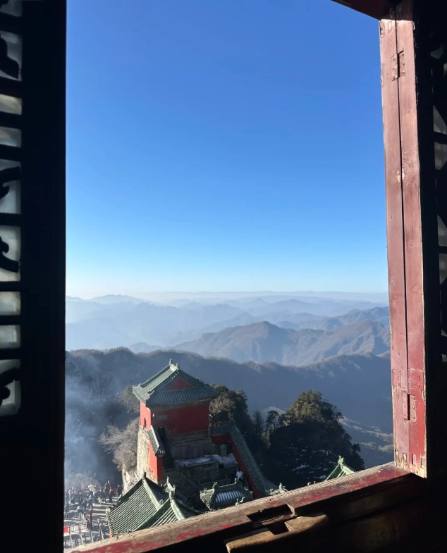
A Realistic Hour-by-Hour Itinerary
I've perfected this timing over many visits. Here's how to beat the crowds and still catch the best light.
- 12:30 PM — Arrive at the scenic area main gate (Jianliang Square). Show your pre-booked QR code and passport to enter. Take the sightseeing bus to South Rock Palace (Nanyan Gong) — about 30 minutes.
- 1:30 PM — Start hiking up the Ming Dynasty trail. You'll mostly pass other hikers coming down (they started in the morning), so you'll have the path mostly to yourself.
- 4:00 PM — Reach the Golden Summit platform. Catch the sunset around 5:30 PM in summer (check local times). The light is perfect for photos, and the tour buses that bring day-trippers are already beginning to leave.
- 5:30 PM — Take the cable car down if you're tired (single ride 90 RMB) or if you'd rather not descend in the dark. The last cable car is usually around 6:30 PM — confirm at the station.
- 6:00 PM — Return to the main gate by sightseeing bus. Wudangshan town has great dining options right outside the scenic gate.
If you're a speed hiker, you might finish the climb in 2.5 hours, but I've planned for a slower pace with photo stops and short breaks. The key is starting late — you'll miss the morning tour groups that clump together like a slow-moving herd.
What to Expect on the Trail: Terrain, Altitude, and Fitness
The Wudang hiking route is a stair-climbing adventure, not a wilderness trek. You'll be on paved stone steps for 90% of the way, with occasional stretches of uneven rock. Some sections are steep enough to require using your hands for balance.
The altitude runs from about 300 meters at the base to 1,612 meters at the Golden Summit. Most hikers feel some shortness of breath on the steeper parts, but it's nothing like high-altitude trekking in Tibet. Take your time and carry plenty of water — you'll need it.
Fitness-wise, I'd rate this a moderate to challenging 7/10. If you exercise regularly, you'll be fine. If you're a casual walker, expect sore legs for two days. A pair of proper hiking shoes with good grip is non-negotiable — I've seen too many people slipping on moss-covered stones.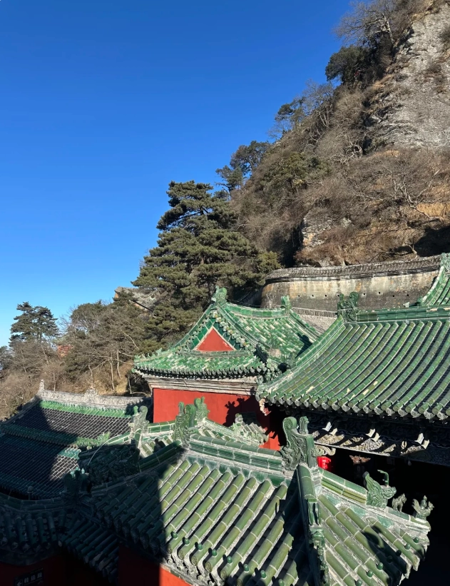
How to Handle Payments, Navigation, and Booking as a Foreigner
Foreign visitors face three major hurdles: payments, maps, and language. Here's how I help my clients navigate them.
Payments: Cash Is Still King (Sometimes)
Inside the scenic area, the ticket office and most shops accept Alipay and WeChat Pay. If you have a foreign credit card linked to those apps (which you should set up before coming), you'll be fine. However, many small stall vendors in the mountains only accept cash. I always carry at least 200 RMB in small bills. You can withdraw cash from ATMs in Wudangshan town, but don't expect to find one on the trail.
Navigation: Google Maps Is Useless Here
Google Maps shows roads that don't exist and fails to update trail paths. Instead, use Apple Maps or Amap (AutoNavi) which has an English mode. Download offline maps of the Wudang area before you arrive, as signal can be patchy on the mountain. For the trails themselves, the signs are well-marked in English, so you won't get lost if you stick to the main paths.
Booking: Skip the WeChat Mini-Program Nightmare
Yes, the official WeChat mini-program is fast for Chinese users, but navigating it in pure Chinese is a nightmare for foreigners. Save yourself the headache and book on Trip.com or Klook. They have English support and usually accept international credit cards. You'll need your passport number to book — make sure it's handy.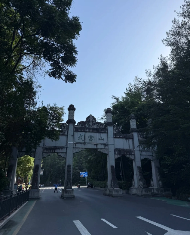
Language and VPN
You'll need a VPN to access Google, WhatsApp, or Instagram while in China. For translation, I recommend Apple Translate or the Baidu Translate app — both can work offline if you download the language pack. In Wudangshan town, a few shopkeepers speak basic English, but it's rare on the mountain itself. A few phrases in Mandarin like “duō shǎo qián” (how much) and “xiè xiè” (thank you) go a long way.
Where to Stay and Eat During Your Wudang Mountains Adventure
You have three main options for lodging: stay in Shiyan city, Wudangshan town (at the gate), or the mountain itself (near the summit). Each has its pros and cons.
| Location | Distance to Trailhead | Estimated Price (per night) | Best For |
|---|---|---|---|
| Shiyan city | 45 min drive | 200-400 RMB | Budget travelers, big-city amenities |
| Wudangshan town | At the gate | 150-500 RMB | Convenience, food stalls, tour groups |
| On-mountain (Golden Summit) | On the summit | 800-2,000 RMB | Sunrise views, quiet, but pricey |
I usually put my clients in Wudangshan town because you can walk to the main gate in 5 minutes and there's a huge variety of restaurants and shops. Try the local specialty: Wudang vegetarian dishes (made with mountain mushrooms and tofu). The “Wudang Taoist meal” at the Zhengyi Guesthouse restaurant is a solid choice — they have picture menus, so ordering is easy.
If you want to catch the sunrise at the Golden Summit (worth it!), you need to stay in the mountain hotel, but book months in advance. The rooms are basic but clean, and the experience is unforgettable.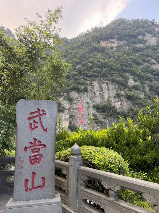



No comments yet.