 Ting Chen
What You'll Find Here
I've been guiding tours in Chongqing for over six years, and nothing humbles a newcomer quite like getting hopelessly lost in the hills. I remember a couple from Belgium — we'd planned a short hike up Nanshan, but they took a wrong turn and ended up two hours away, with no data signal. That's when I realized: the right map app isn't a luxury; it's survival gear. In this guide, I'll cut through the noise and share exactly which Chongqing map app for hills actually works, how to set it up, and the mistakes you don't want to make. No fluff, just field-tested advice.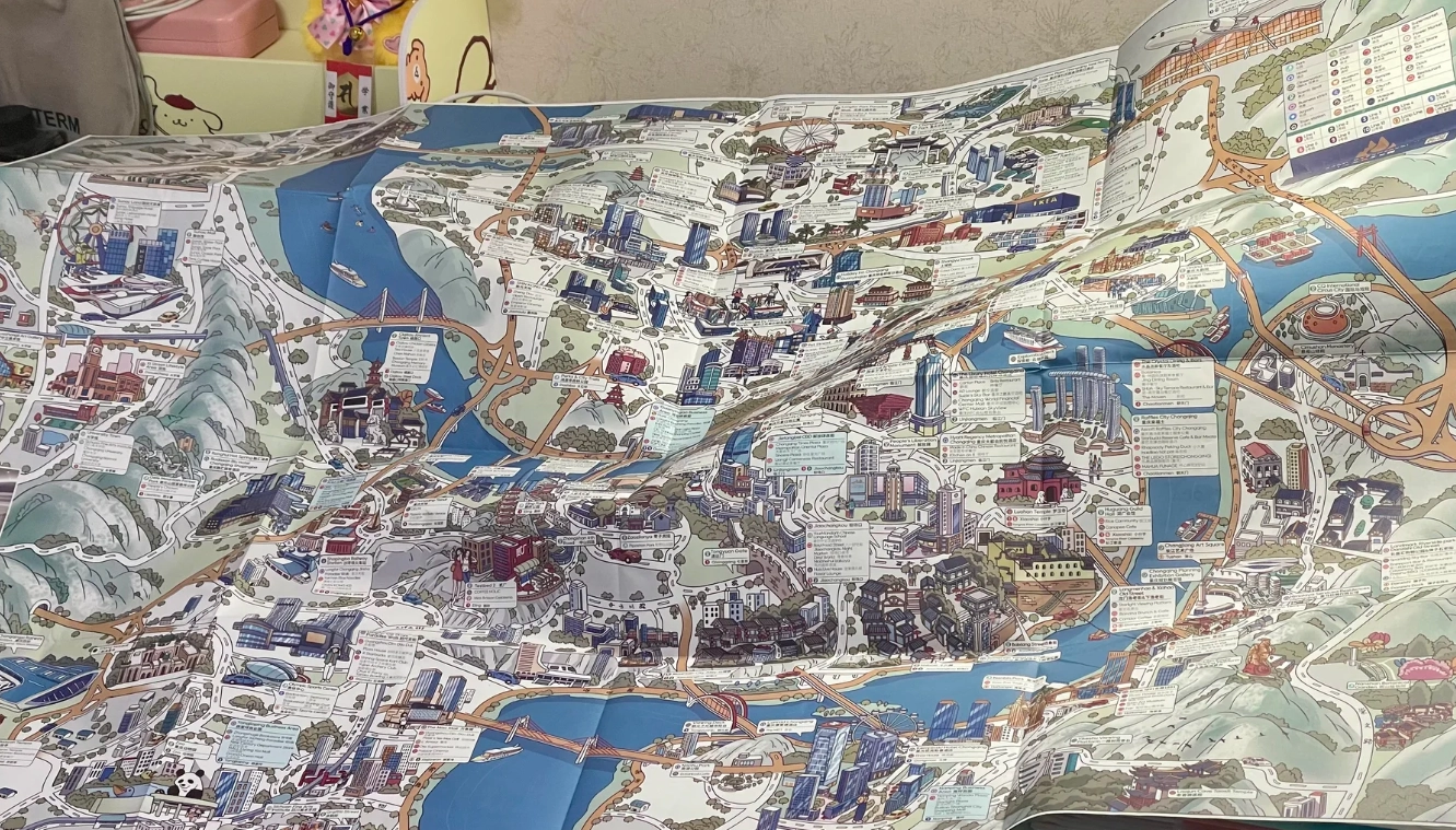
Why Google Maps Fails in Chongqing's Hills
Google Maps is the default for most travelers, but in Chongqing's vertical terrain, it's borderline useless. The app is officially blocked in China — even with a VPN, the data is often outdated or misaligned. More importantly, Google Maps doesn't account for the city's three-dimensional layout. A "short walk" might involve climbing 300 stairs or taking a hidden elevator that only locals know. I've seen tourists stare at their phones, convinced the destination is right next to them — only to discover it's actually on a different elevation level.
The Elevation Nightmare
Chongqing is built on mountains, so a straight line on a 2D map means nothing. Many roads are actually bridges or tunnels, and pedestrian paths often involve staircases that don't appear on standard maps. Google Maps doesn't show elevation changes, step counts, or the entrances to underground passages that cut through hills. Trust me, you don't want to follow a car route that sends you up a highway with no sidewalks.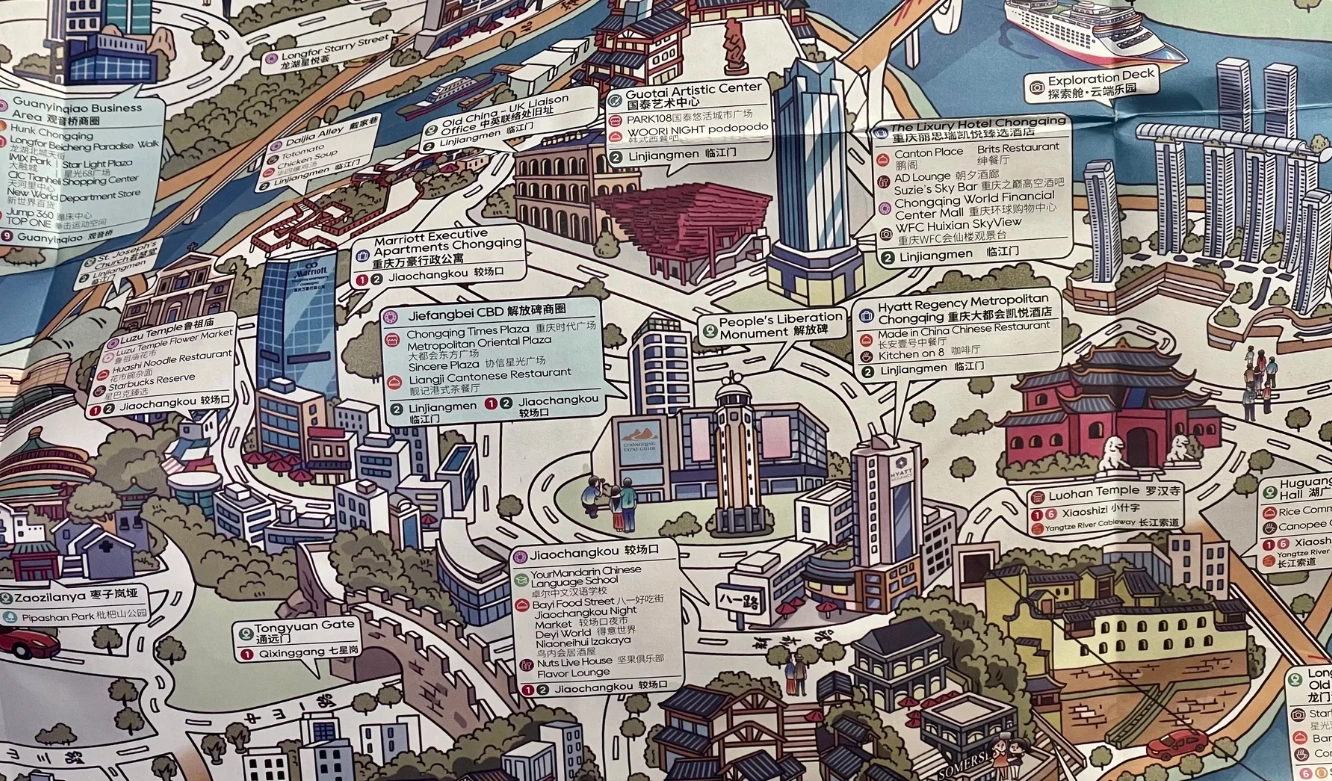
Real-World Accuracy
When I tested Google Maps last month near Eling Park, it insisted the nearest bus stop was 50 meters away — but that "road" was a construction site. Meanwhile, local apps had the correct reroute. My advice: treat Google Maps as a rough reference only, and download a backup that works offline and understands Chongqing's topography.
Top 5 Map Apps for Navigating Chongqing's Hills
After years of trial and error, here are the apps I recommend to every traveler heading into the hills. I've included a comparison table to help you choose based on your needs.
| App | Offline Maps | Hiking Trails | Public Transport | English Interface | Best For |
|---|---|---|---|---|---|
| Amap (Gaode) | Yes | Limited | Excellent | Partial | Urban hills & public transit |
| Baidu Maps | Yes | Good | Excellent | Minimal | Comprehensive coverage |
| Apple Maps | Yes | No | Good | Full | English speakers, basic nav |
| MAPS.ME | Yes | Yes | Basic | Full | Offline hiking |
| Komoot | Yes | Excellent | No | Full | Serious hikers |
1. Amap (Gaode) — The Local King
Amap is the most widely used navigation app in China, and for good reason. It has the most accurate real-time traffic and public transit data, including bus lines that snake through the hills. The interface is mostly in Chinese, but you can use Google Translate's camera feature to read menu options. Pro tip: Download the "Global" version (called "Amap" in English) which offers partial English support. It also shows staircases and footbridges in some areas, though not all. For everyday navigation between hills, this is my go-to.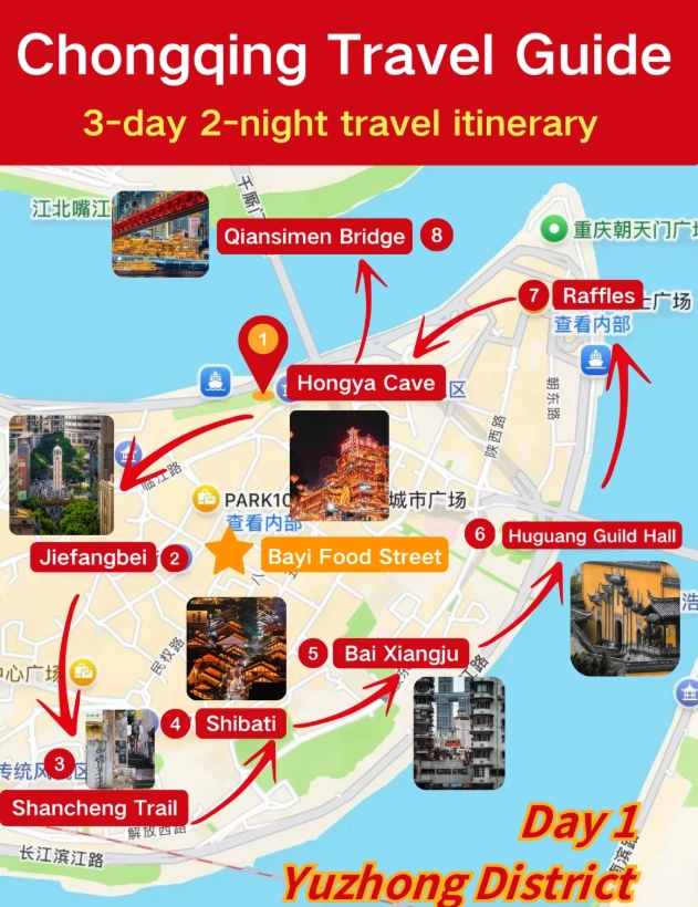
2. Baidu Maps — Runner-Up
Baidu Maps is a close competitor with slightly better hiking trail data. It includes user-contributed hiking routes for popular hills like Nanshan and Gele Mountain. The English interface is even less intuitive than Amap, but it does have a "scenic trail" layer. I've found it more reliable for finding the start of hiking paths, especially around Tieshanping Forest Park. Downside: It consumes more battery and data.
3. Apple Maps — Surprisingly Reliable
If you're an iPhone user, Apple Maps works reasonably well in Chongqing — better than Google. It uses high-resolution satellite imagery and integrates with public transit data from local agencies. The elevation view is available for some walking routes, and it's fully in English. However, it lacks dedicated hiking trails and offline maps for China. Use it for quick urban navigation, but not for deep hill treks.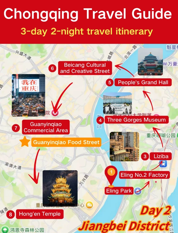
4. MAPS.ME — Offline Savvy
For hikers who want to avoid data charges entirely, MAPS.ME is a lifesaver. It offers detailed offline maps with contour lines and hiking trails contributed by the OpenStreetMap community. I've downloaded the entire Chongqing region in advance, and it's saved me multiple times when I lost signal on a mountain path. The app shows points of interest like mountain temples and viewpoints, but public transit data is spotty. Best paired with a bus app.
5. Komoot — For Serious Hikers
If you plan to tackle multi-hour hikes like the Yangtze River Cliff Walk or the Huaying Mountain range, Komoot is unmatched. It has turn-by-turn voice navigation for hiking, detailed elevation profiles, and surface type information (stone steps vs. dirt trail). The community highlights obstacles like fallen trees or steep sections. Caution: Komoot requires a premium subscription for offline maps in China, and the map purchases are per region. But for serious hikers, it's worth every penny.
How to Use These Apps Like a Pro
Having the app is one thing; using it effectively in Chongqing's hills is another. Here's what I've learned from guiding hundreds of travelers.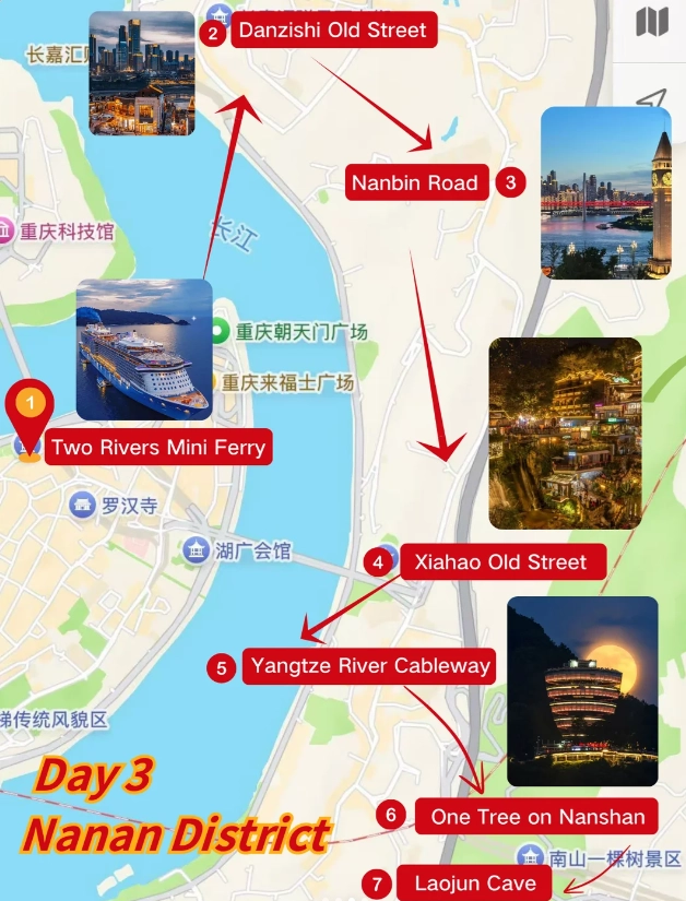
Download Offline Maps Before You Arrive
Chongqing's hills often have weak or no signal — especially in valleys between peaks. All five apps above allow offline downloads. For Amap, open the app, search for "Chongqing" and select the download button. Make sure to include the surrounding mountain areas like Nanshan, Gele, and Tieshanping. This step alone can save you from a panic-stricken afternoon.
Use Public Transport Mode for Hills
Driving in Chongqing's hills is stressful for even locals. Instead, use the app's public transit function. It will often recommend a combination of metro, bus, and even cable cars. For example, to reach the start of the Nanshan hiking trail, Amap will direct you to take Line 6 to Shangxinjie, then a bus up the hill — with walking instructions that include staircases. Ignore the driving ETA; it's often longer due to winding roads.
Look for Elevation Profiles on Komoot or MAPS.ME
Before starting a hike, check the elevation gain. Chongqing's hills are relentless — a 2 km trail can have 400 meters of vertical climb. Komoot shows this clearly. If you're not prepared, you might exhaust yourself on a "short" walk. I always tell my clients: plan for twice the time you'd expect on flat terrain.
Insider Hiking Tips for Chongqing's Hills
After dozens of hikes with guests, here are the nuggets that make a difference.
The Golden Window: 4 PM to 6 PM
Most guidebooks recommend morning hikes. But I've watched too many people roast under the midday sun, especially from June to September. The light is harsh, and the humidity is killer. Instead, start your hill hike around 4 PM. The temperature drops, the sunlight softens for photography, and you'll catch the sunset over the Yangtze. Plus, many trails are less crowded at that hour.
Wear Proper Footwear — Not Sneakers
Chongqing's hills have a mix of uneven stone steps, loose gravel, and occasional mud. I've seen tourists in fashion sneakers slipping and turning their ankles. Light hiking shoes or trail runners with good grip are essential. Pro tip: Bring a pair of walking poles if you have weak knees — the descents are steep.
Cash is Still King at Trail Shops
Many small convenience stores at trailheads or mid-hill stalls don't accept international credit cards. While Alipay and WeChat Pay are widely used by locals, they may not accept foreign bank cards. Always carry some Chinese yuan (cash) for water, snacks, or emergency rest stops. I've seen travelers stranded without cash, unable to buy water on a hot day.
Beware of the "Shortcut" on Google Maps
Google Maps often suggests a shortcut that turns out to be a 500-step staircase. If you're not up for that, stick to the local apps. I once followed a Google Maps walking route that ended at a locked gate. Since then, I triple-check with Amap or Baidu before committing. If an app shows a dirt path across a contour line, it's probably a goat trail — not a shortcut.








It's decent, but I didn't love it as much as the reviews said. The idea is great—mapping all the steep shortcuts and elevators—and we did find a useful stairway from the Yangtze River Cableway station. But the app kept suggesting routes that involved narrow, dark alleys at night, and the 'local shortcut' labels were confusing. Also, a couple of the elevator options were actually closed to tourists. So mixed feelings. Fine for daytime, just don't rely on it after dark.
Good app overall, and the pedestrian bridge and staircase info is really useful. We managed to navigate around Jiefangbei without having to climb unnecessary stairs, which was huge after a long day. I'm giving 4 stars because the app drained my phone battery pretty fast, and the live route recalculation occasionally froze for a few seconds. But it definitely did the job and is way better than other maps for central Chongqing.
As a map nerd, I appreciate how they layered contour lines over the subway network. The augmented reality mode pointing to the correct skywalk when your GPS signal goes crazy in the city's concrete canyons? Amazing. Also found a tiny noodle shop off an alleyway that only appeared on this app. Fantastic for exploring and for finding elevator shortcuts. Genuinely one of the best travel tools I've ever used.
I'm a hiker and I thought Chongqing would be easy. Wrong. This app is like having a local friend whisper which slope is too steep. The 'hilly difficulty' indicator for each route is genius. We could choose a longer but less brutal path with shaded crossings. Also the navigation voice is so calm. It made a chaotic city feel manageable. Already told two friends coming to China to download it.
Used this app for three days in Yuzhong District and it totally saved me. The stair shortcuts are spot on—we got from Liziba to the rail station through a walkway that Google Maps didn't even know about. It even tells you when a public elevator is out of service! My legs were still tired, but at least we never ended up going the wrong way around a mountain. 10/10.