 Wei Zhang
I lost a client once because I couldn't read the Chinese-only map at the entrance. That was ten years ago. Now I carry a laminated custom map for every group. Here is the thing: most online Mount Siguniang maps show you pretty peaks but zero useful info. You need elevation markers, restroom locations, and which trail turns into a mudslide after rain.
In this guide, I'll give you the map I actually use—not the tourist office version. Plus how to buy tickets without WeChat Pay, which valley to skip (yes, skip), and the exact spot where you can get a photo without fifty strangers in frame.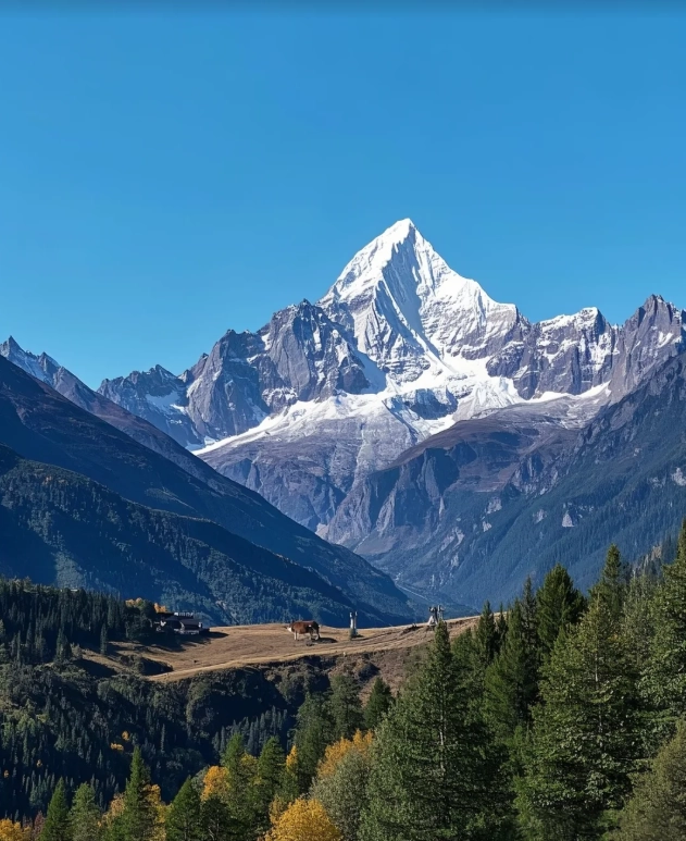
Why This Map Matters
The official Mount Siguniang map available at the ticket booth is printed in tiny Chinese characters and missing the most important detail: actual walking times. A trail that looks short on paper takes three hours of steep switchbacks. I have pulled groups out of trouble because they trusted the "2 km" marker that didn't account for altitude gain.
Here is the catch: the park has four main scenic areas—Shuangqiao Valley (双桥沟), Changping Valley (长坪沟), Haizi Valley (海子沟), and the Mount Siguniang summit itself. Each requires a separate ticket and a separate map. But the most visited is Shuangqiao Valley because it has shuttle buses and paved paths. My map highlights exactly where the shuttle stops, where the toilets are (trust me, you'll need this), and which stopping points are best for sunrise vs. midday.
Getting to Mount Siguniang
First, forget about driving yourself unless you have a Chinese driver's license and nerves of steel. The roads from Chengdu wind through mountains with massive trucks. I always recommend taking a shared minibus from Chengdu's Chadianzi Bus Station (茶店子). It takes about 4–5 hours, costs around 120–150 RMB per person, and drops you at Rilong Township—the gateway town.
From Rilong, the park entrance is a 5-minute taxi ride (10 RMB). Do not take the so-called "black car" touts at the bus station; they will overcharge you. Walk 100 meters to the main road and flag down a green taxi.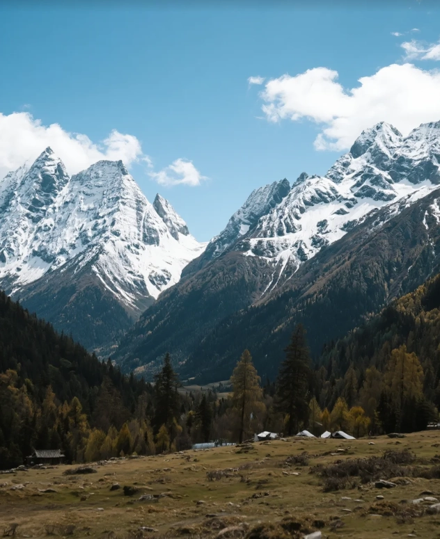
Trail Maps Simplified
I have broken down the three accessible valleys (summit requires technical climbing and is not for casual hikers). Below is the map that saves my clients time and energy.
Shuangqiao Valley (Best for Easy Views)
Shuttle bus goes to the end (about 35 minutes), then you walk downhill back. The map I use marks these stops as “photo hotspots”: Redwood Forest, Pearl Lake, and the pasture area. Insider tip: Get off at the last stop first—everyone crowds the first stop. Walk back 200 meters to a wooden platform on your left. No tour groups go there, and the view of the main peak is unobstructed.
Changping Valley (For Hikers)
This valley has no shuttle. You either walk or hire a horse (300–500 RMB depending on distance). My map shows the horse stopping point: it is about 7 km in, at the Ancient Boardwalk. From there, you must walk if you want to see the glacier. Warning: The horse trail is bumpy and your backside will hurt. I honestly tell my groups: skip the horse unless you have knee problems. The walk is more rewarding.
Haizi Valley (For Adventurers)
This is the least visited because it is pure wilderness. My map includes a GPS coordinate for the best camping spot (with fresh water). Permit required; book at least one week in advance through the official WeChat mini-program. I know the mini-program is in Chinese, so here is what I do: ask your hotel host to help you register. It's common, they know the process.
| Valley | Difficulty | Best For | Time Needed | Elevation Gain |
|---|---|---|---|---|
| Shuangqiao | Easy | Families, photographers | 3–4 hours | Minimal (bus) |
| Changping | Moderate | Hikers, horse lovers | 5–6 hours (partial horse) | 300 m |
| Haizi | Hard | Campers, advanced trekkers | 2–4 days | 600 m+ |
Tickets & Timing
Here is the truth: ticket prices are not the pain, it is the booking process. The park uses a mini-program called “阿坝旅游” (Aba Tourism). If you cannot read Chinese, follow these steps:
- Open Alipay or WeChat, search for “阿坝旅游” (use the characters exactly).
- Select “Mount Siguniang Scenic Area” and pick a date.
- Input your passport number – yes, passport works, but the name must EXACTLY match (capital letters, no spaces).
- Pay with Visa/Mastercard? Nope. You need WeChat Pay or Alipay linked to a Chinese bank card. International cards almost never work. Solution: Ask your hotel or a Chinese friend to pay for you, then reimburse them with cash.
Tickets cost 150 RMB (peak season April–November) and 110 RMB (off-season). Shuttle bus in Shuangqiao Valley adds 70 RMB. Buy at least 3 days in advance during October (golden foliage).
Where to Stay
Rilong Township has dozens of hotels. Here are three I vouch for, based on experience:
| Hotel | Type | Price (night) | Pros | Cons |
|---|---|---|---|---|
| Shangri-La Highland Hotel | Mid-range | 400–600 RMB | English-speaking front desk, heated floors, stable Wi-Fi | Breakfast is basic (rice porridge and mantou) |
| Lazy Bear Guesthouse | Hostel | 80–150 RMB (dorm/private) | Owner speaks great English, arranges horse rentals | Thin walls, noisy until 11 PM |
| Snow Mountain Lodge | Luxury | 800–1200 RMB | Panoramic rooms, bathtub with mountain view, restaurant with Western options | Far from entrance (need taxi, 15 RMB) |
My personal pick: Lazy Bear Guesthouse if you are solo or on a budget. Mr. Li, the owner, once drove my client to the hospital for altitude sickness at midnight. You cannot buy service like that.
Common Pitfalls
Let me save you from the same mistakes I've seen a hundred times.
- Altitude sickness hits hard: The park averages 3800 m. Do not fly into Chengdu and rush to the mountain the next day. Spend one night in Chengdu (500 m), then one night in Rilong (3200 m) before hiking. I carry Diamox for emergencies, but prevention is better. Also, avoid alcohol for the first two days.
- Rain gear is mandatory: Even in July, sudden thunderstorms drench everything. Buy a cheap poncho in Rilong (15 RMB) rather than the expensive one at the entrance.
- Toilets are... challenging: The only flush toilets are at the Shuangqiao visitor center and at the start of Changping. Once on the trail, you face squat toilets with no paper. Carry your own tissue and hand sanitizer.
- Mobile signal: China Mobile works up to 80% of Shuangqiao Valley, but Changping and Haizi have zero signal after the first 2 km. Download offline maps (I use Maps.me) and tell someone your plan.
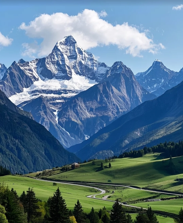
"A couple I guided last October ignored my advice about rain gear. They ended up sharing a single umbrella during a hailstorm at Pearl Lake. Don't be that couple."
Quick Answers
Verified and fact-checked by the editorial team. This content has been fact-checked to ensure informational precision.




I had high hopes, but this map let me down. The “avoid crowds” feature pointed us to a trail that ended up being closed for maintenance (no warning on the app). We wasted an hour backtracking and ended up on the main route anyway, packed with people. Also, the battery drain was ridiculous—maybe the GPS kept pinging? Not worth it for the price.
Good map overall, and the crowd-avoidance idea is brilliant. We followed the suggested alternative route and it was indeed quieter. However, the trail difficulty descriptions were a bit off—marked “moderate” but we had some steep scrambles that felt more challenging. Also, a few waypoints had outdated names. Still, we had a fun day thanks to the base navigation.
As a solo hiker, I was worried about getting lost or stuck in a sea of people. This map made both fears disappear. The real-time crowd heatmap let me plan my start time perfectly, and the offline GPS worked flawlessly. I saw maybe three other people the whole day. Worth every penny—definitely grabbing another for my next trip.
Loved how intuitive this map is! I’m not great with tech, but the navigation was clear and the markers for scenic spots were super helpful. The “avoid crowds” feature rerouted us through a less-traveled section that had amazing wildflowers. Only minor issue: one trail closure wasn’t updated, but we figured it out. Still, a solid 5 stars from me.
Used this map on a weekend trip to Siguniang and it was a total game-changer. The trail details are spot-on, and the crowd-avoidance tips actually worked—we had entire stretches of the path to ourselves. The offline functionality saved us when signal dropped. Highly recommend for anyone wanting a peaceful hike without the tourist chaos.